 |
Maps showing
the Locations of Grave Sites
|
|
Maps showing
the Locations of Grave Sites
|
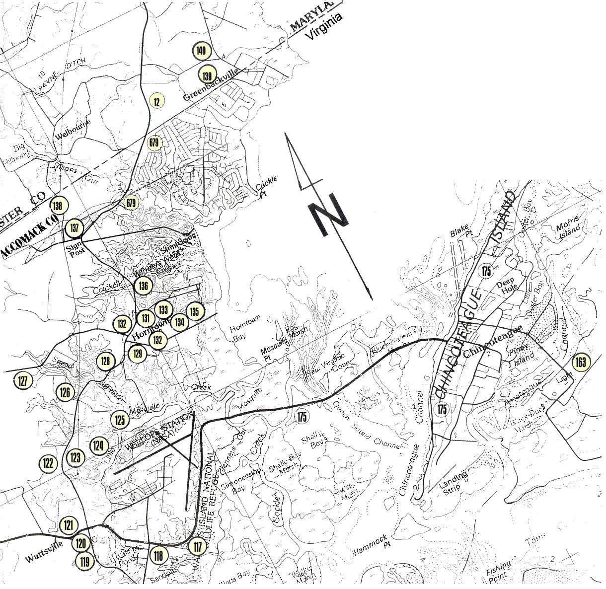
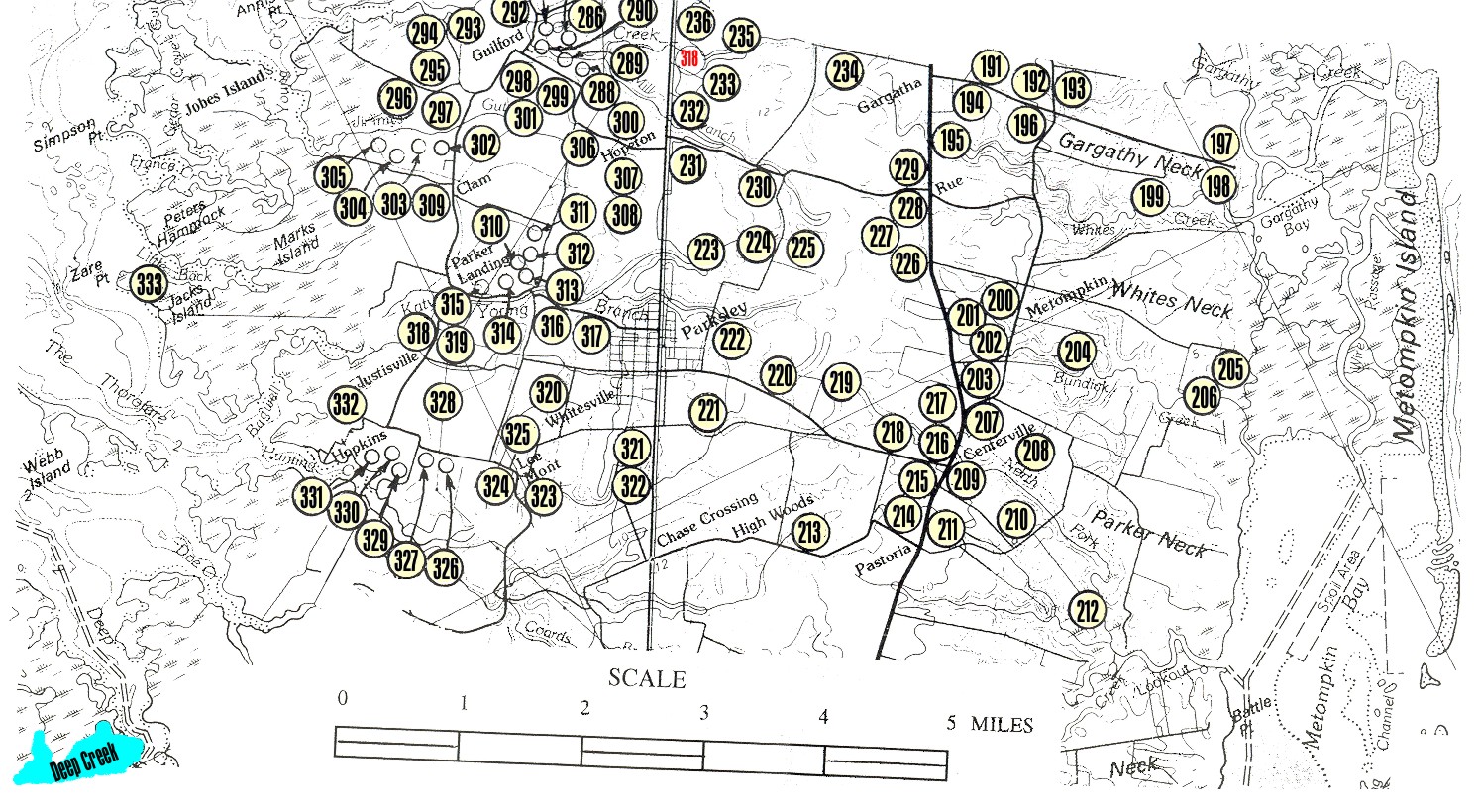
![]() Map 1
of Upper Accomack County Showing Cemetery Location, by number.
Map 1
of Upper Accomack County Showing Cemetery Location, by number.
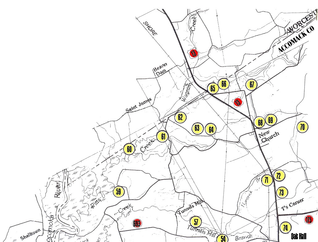
![]() Map 2 of
Upper Accomack County Showing Cemetery Location, by number.
Map 2 of
Upper Accomack County Showing Cemetery Location, by number.
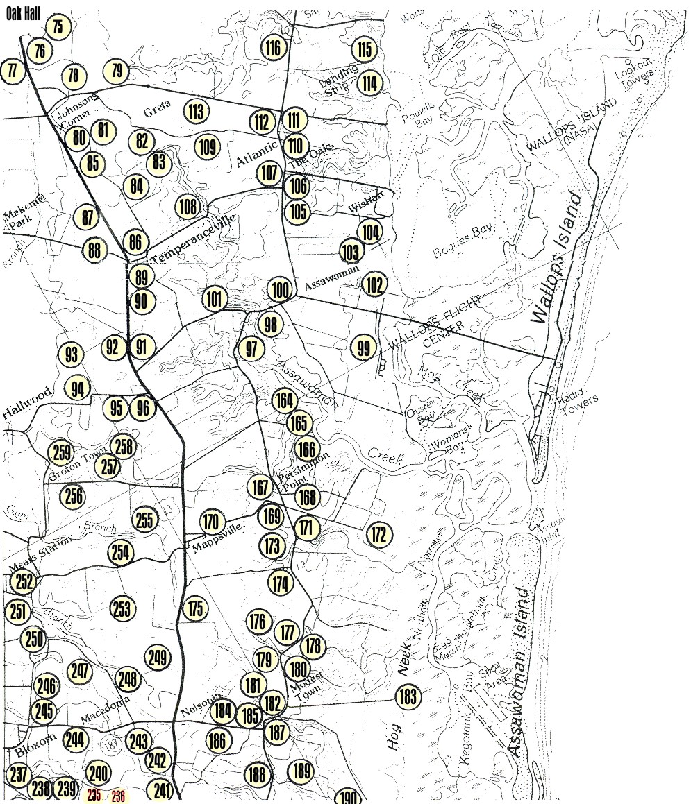
![]() Map 3 of
Upper Accomack County Showing Cemetery Location, by number.
Map 3 of
Upper Accomack County Showing Cemetery Location, by number.
![]() Map 4 of
Upper Accomack County Showing Cemetery Location, by number.
Map 4 of
Upper Accomack County Showing Cemetery Location, by number.
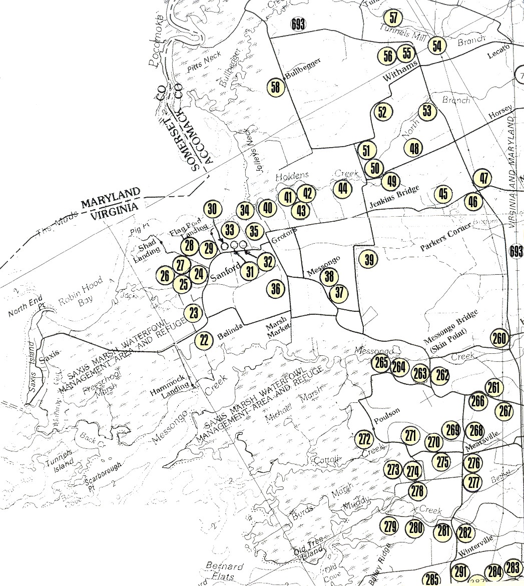
![]() Map 5 of
Upper Accomack County Showing Cemetery Location, by number.
Map 5 of
Upper Accomack County Showing Cemetery Location, by number.
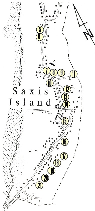
![]() Map 6 -
Saxis Island Showing Cemetery Location, by number.
Map 6 -
Saxis Island Showing Cemetery Location, by number.
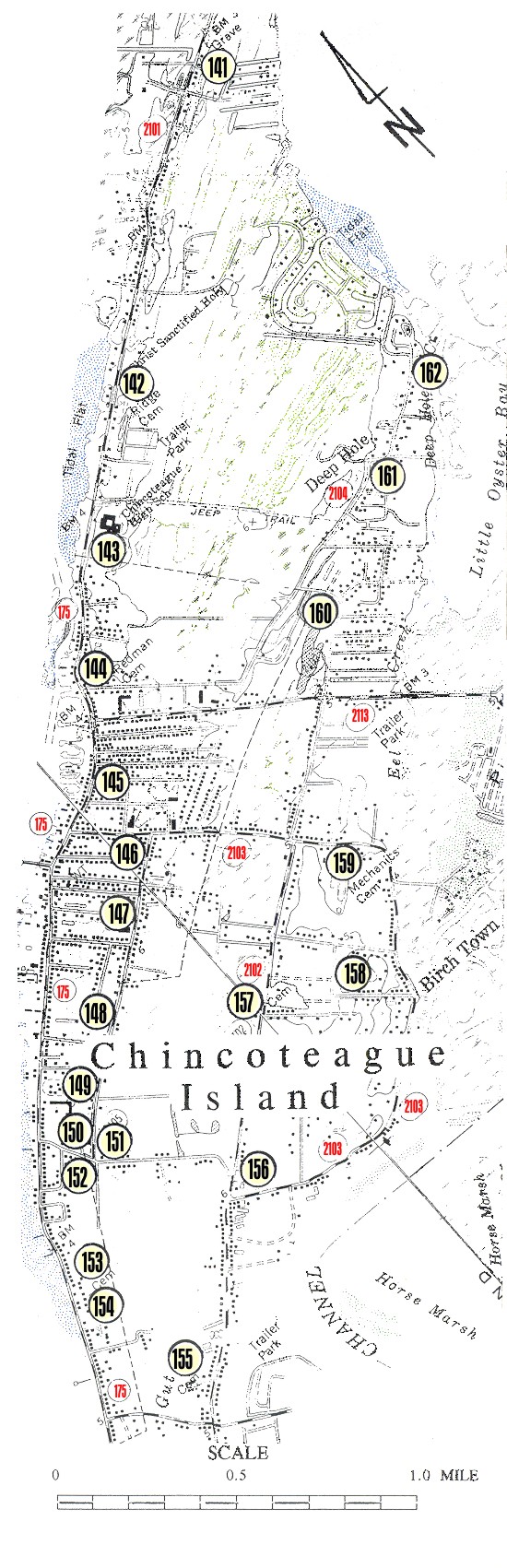
![]() Map 7 -
Chincoteague Island Showing Cemetery Location, by number.
Map 7 -
Chincoteague Island Showing Cemetery Location, by number.
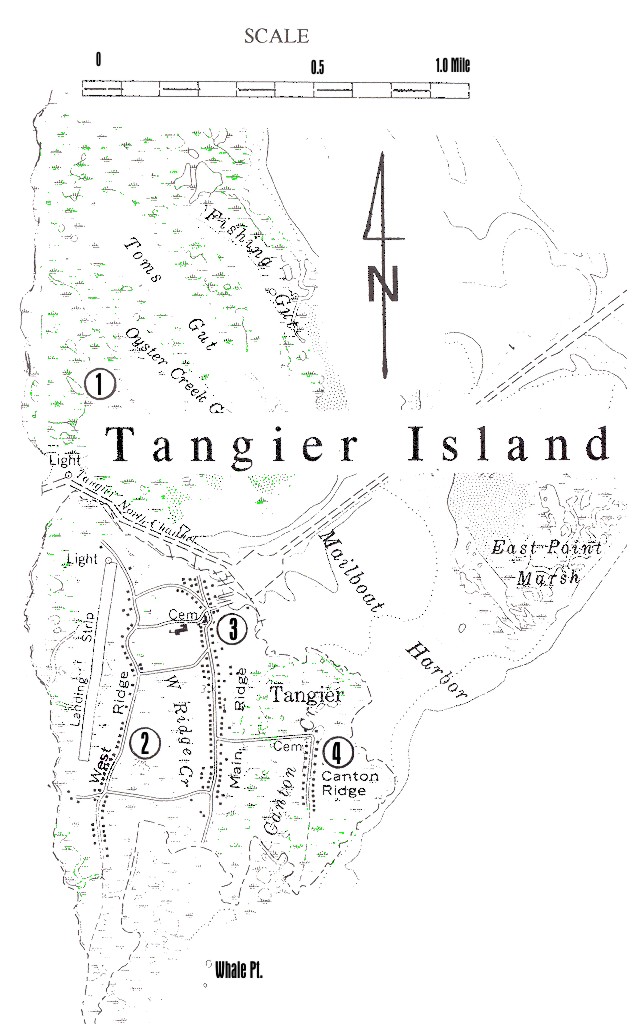
![]() Map 8 -
Tangier Island Showing Cemetery Location, by number
Map 8 -
Tangier Island Showing Cemetery Location, by number
![]() Return to
Location
Descriptions of Grave Sites In Upper Accomack County Virginia
Return to
Location
Descriptions of Grave Sites In Upper Accomack County Virginia
![]() Return to
The Ghotes virtual cemetery
Return to
The Ghotes virtual cemetery
![]() Return to
the Ghotes home page
Return to
the Ghotes home page
Copyright © 2001-2002 Most recent revision: Wednesday, October 16, 2002 21:29:09(jb)